2020
TQ2251 : Buckland Lane
taken 4 years ago, near to Buckland, Surrey, England
This is 1 of 2 images, with title Buckland Lane in this square
Buckland Lane
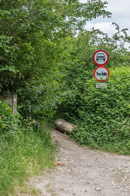
Prohibition signs on Buckland Lane where it meets Lawrence Lane. Previously a Byway Open to All Traffic ("BOAT"), its use was restricted from 3 April 2018 by a Traffic Restriction Order, replacing a temporary order introduced in 2015 following subsidence taking out the embankment on part of the route.
 Map © Crown Copyright")
TIP: Click the map for more Large scale mapping
- Grid Square
- TQ2251, 135 images (more nearby 🔍)
- Photographer
- Ian Capper (more nearby)
- Date Taken
- Wednesday, 27 May, 2020 (more nearby)
- Submitted
- Sunday, 31 May, 2020
- Subject Location
-
OSGB36:
 TQ 227 519 [100m precision]
WGS84: 51:15.1963N 0:14.5830W - Camera Location
-
OSGB36: TQ 227 519
- View Direction
- NORTH (about 0 degrees)