2020
SE3521 : Junction of Neil Fox Way and Park Lodge Lane (east side)
taken 4 years ago, near to Stanley, Wakefield, England
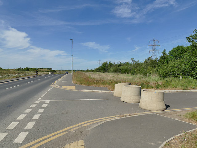
Junction of Neil Fox Way and Park Lodge Lane (east side)
The new Wakefield Eastern Relief Road, this part of which is named Neil Fox Way, intercepts the older route of Park Lodge Lane at an oblique angle, so the lane has been realigned as seen in SE3521 : Park Lodge Lane, blocked. Concrete pipe sockets have been used as a crude way of closing it to motor traffic.
 Map © Crown Copyright")
TIP: Click the map for more Large scale mapping
- Grid Square
- SE3521, 313 images (more nearby 🔍)
- Photographer
- Stephen Craven (more nearby)
- Date Taken
- Monday, 25 May, 2020 (more nearby)
- Submitted
- Sunday, 31 May, 2020
- Subject Location
-
OSGB36:
 SE 3523 2157 [10m precision]
WGS84: 53:41.3639N 1:28.0799W - Camera Location
-
OSGB36: SE 3522 2157
- View Direction
- North-northeast (about 22 degrees)