2020
SO6412 : Distance marker post on the Mineral Loop
taken 4 years ago, near to Ruspidge, Gloucestershire, England
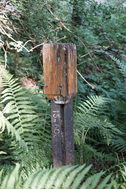
Distance marker post on the Mineral Loop
In places, the cycle path deviates from the actual course of the mineral loop. One of these places is the bit in between Lightmoor Colliery and the Dilke Hospital, and lurking in the undergrowth on that section is this old distance marker post. The distance markings - representing, presumably, the distance to Lydney as the HQ of the Severn & Wye's system - would have originally been displayed in raised numerals on each face of the wooden sign; they have been replicated in paint on the sign post, possibly after closure of the line in an attempt to preserve what the sign said.
 Map © Crown Copyright")
TIP: Click the map for more Large scale mapping
- Grid Square
- SO6412, 65 images (more nearby 🔍)
- Photographer
- John Winder (more nearby)
- Date Taken
- Tuesday, 2 June, 2020 (more nearby)
- Submitted
- Wednesday, 3 June, 2020
- Subject Location
-
OSGB36:
 SO 6408 1219 [10m precision]
WGS84: 51:48.4311N 2:31.3430W - Camera Location
-
OSGB36: SO 6408 1219
- View Direction
- EAST (about 90 degrees)