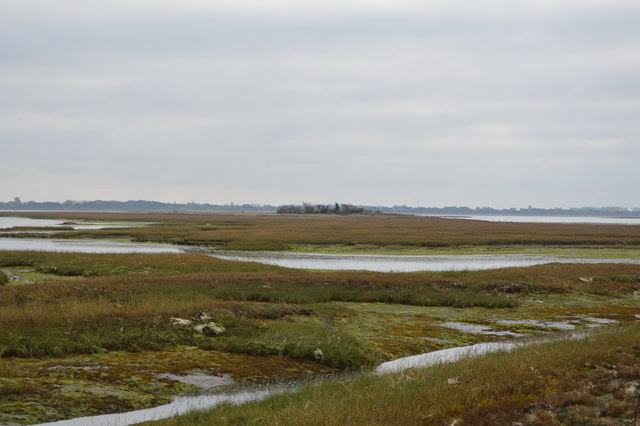
SU6904 : North Binness Island
taken 5 years ago, near to Farlington, Portsmouth, England
Farlington Marshes is a 120 hectare Local Nature Reserve in Hampshire. It is owned by Portsmouth City Council and managed by Hampshire and Isle of Wight Wildlife Trust. It is part of Langstone Harbour, which is a Site of Special Scientific Interest and a Grade I Nature Conservation Review site. It is also part of Solent Maritime Special Area of Conservation and of Chichester and Langstone Harbours Ramsar site and Special Protection Area.
Farlington Marshes is an area of reclaimed land. It was reclaimed from the harbour in 1771 and includes a larger part of what was formerly Binner's Island (the remainder of the island is now referred to as North Binness Island). Farlington Marshes features both freshwater marsh and brackish marsh. It is a feeding ground for overwintering Brent geese. During World War 2 it was used as a starfish site acting as a decoy for Portsea Island. The control blockhouses remain on the marshes. (wikipedia)
Langstone Harbour is an inlet of the English Channel in Hampshire, sandwiched between Portsea Island to the south and west, Hayling Island to the south and east, and Langstone to the north. Geographically it is a ria.
Together with Chichester Harbour, which is at the other (eastern) side of Hayling Island it is designated as a Special Protection Area for wildlife. West of Portsmouth is Portsmouth Harbour and the three linked harbours are important recreational and conservation areas as well as supporting commercial fishing and shipping. It is administered by the Langstone Harbour Board.
Wikipedia: Link
 Map © Crown Copyright")
- Grid Square
- SU6904, 15 images (more nearby 🔍)
- Photographer
- N Chadwick (more nearby)
- Date Taken
- Thursday, 25 October, 2018 (more nearby)
- Submitted
- Tuesday, 9 June, 2020
- Subject Location
-
OSGB36:
 SU 6959 0454 [10m precision]
WGS84: 50:50.1730N 1:0.7874W - Camera Location
-
OSGB36: SU 6903 0491
- View Direction
- East-southeast (about 112 degrees)