2019
SD8183 : Grove Head
taken 5 years ago, 4 km SSW of High Houses, North Yorkshire, England
This is 1 of 3 images, with title Grove Head in this square
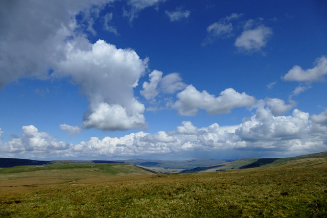
Grove Head
Grove Head gathers the headwaters of Snaizeholme Beck on the way to Upper Wensleydale. Below the edge of the limestone outcrop, the land rapidly changes to peat moorland - acid soil mainly supporting sedges which in this season are showing yellow/orange remains of last years growth - there is green down at the base but it is not yet visible at any distance. Limestone outcrops again on Snaizeholme Fell - the noticeably greener area on the left of the photo
 Map © Crown Copyright")
TIP: Click the map for more Large scale mapping
- Grid Square
- SD8183, 26 images (more nearby 🔍)
- Photographer
- Andy Waddington (more nearby)
- Date Taken
- Saturday, 11 May, 2019 (more nearby)
- Submitted
- Friday, 12 June, 2020
- Subject Location
-
OSGB36:
 SD 814 836 [100m precision]
WGS84: 54:14.8646N 2:17.2167W - Camera Location
-
OSGB36: SD 8133 8318
- View Direction
- North-northeast (about 22 degrees)