2017
NZ2463 : Paddling under the Queen Elizabeth II bridge on the Tyne
taken 7 years ago, near to Gateshead, England
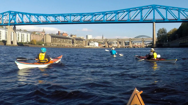
Paddling under the Queen Elizabeth II bridge on the Tyne
Since the River Tyne is tidal several kilometres upstream of central Newcastle, it provides a very leisurely way to see the city from an unusual perspective and with very little traffic to worry about. We had put on at Derwenthaugh near high tide and the ebb was now helping us along our way towards the North Sea - it hadn't picked up a lot of speed yet, as this was quite early in the trip. Queen Elizabeth II bridge is one of the more recent additions to the river whilst ahead of us lie the High Level bridge, the Swing bridge and, most distinctive, the Tyne Bridge itself. The newest bridge, the Millennium, is still hidden by the gentle curve of the river, whilst two other bridges are already behind us.
 Map © Crown Copyright")
TIP: Click the map for more Large scale mapping
- Grid Square
- NZ2463, 1552 images (more nearby 🔍)
- Photographer
- Andy Waddington (more nearby)
- Date Taken
- Sunday, 15 October, 2017 (more nearby)
- Submitted
- Saturday, 13 June, 2020
- Subject Location
-
OSGB36:
 NZ 2481 6337 [10m precision]
WGS84: 54:57.8608N 1:36.8423W - Camera Location
-
OSGB36: NZ 2475 6327
- View Direction
- North-northeast (about 22 degrees)