2020
SK6746 : View across the Trent Valley from Barker Hill
taken 4 years ago, near to Lowdham, Nottinghamshire, England
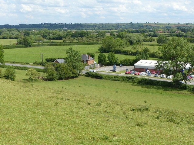
View across the Trent Valley from Barker Hill
The steep slope in the foreground is the river cut, matching the scarp visible on the far side of the alluvial valley floor. The modern course of the River Trent is on the far side.
 Map © Crown Copyright")
TIP: Click the map for more Large scale mapping
- Grid Square
- SK6746, 79 images (more nearby 🔍)
- Photographer
- Alan Murray-Rust (more nearby)
- Date Taken
- Saturday, 13 June, 2020 (more nearby)
- Submitted
- Monday, 15 June, 2020
- Subject Location
-
OSGB36:
 SK 6750 4660 [10m precision]
WGS84: 53:0.7476N 0:59.7222W - Camera Location
-
OSGB36: SK 6734 4666
- View Direction
- East-southeast (about 112 degrees)