2020
NY2759 : Easton Marsh, Drumburgh
taken 4 years ago, near to Drumburgh, Cumbria, England
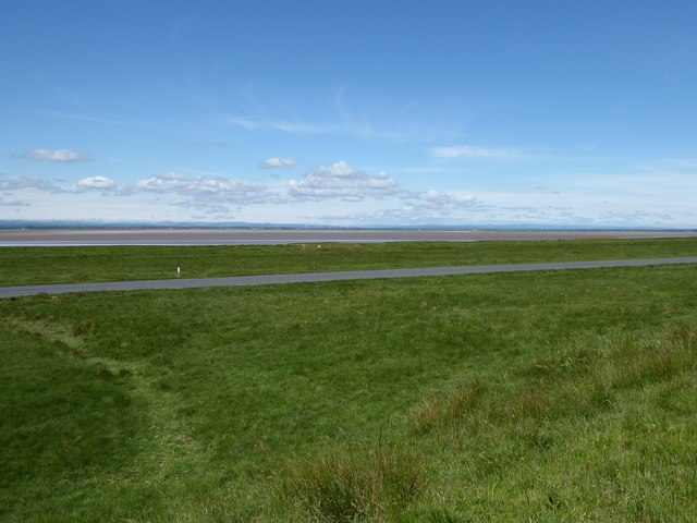
Easton Marsh, Drumburgh
The salt marsh east of Drumburgh looking across the Solway Firth to Scotland. The road in the foreground is part of the Hadrian's Wall Path National Trail and both this and the salt marsh are flooded by the highest spring tides.
The salt marsh is used as pasture for both sheep and cattle.
The salt marsh is used as pasture for both sheep and cattle.
 Map © Crown Copyright")
TIP: Click the map for more Large scale mapping
- Grid Square
- NY2759, 26 images (more nearby 🔍)
- Photographer
- Adrian Taylor (more nearby)
- Date Taken
- Sunday, 14 June, 2020 (more nearby)
- Submitted
- Monday, 15 June, 2020
- Subject Location
-
OSGB36:
 NY 2727 5981 [10m precision]
WGS84: 54:55.6591N 3:8.1867W - Camera Location
-
OSGB36: NY 2711 5966
- View Direction
- Northeast (about 45 degrees)