2017
SE1534 : Benchmark on Manningham Lane wall at Spring Bank Place junction
taken 7 years ago, near to Frizinghall, Bradford, England
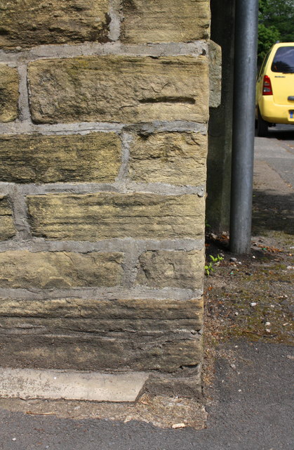
Benchmark on Manningham Lane wall at Spring Bank Place junction
Ordnance Survey cut mark benchmark described on the Bench Mark Database at Link
 Map © Crown Copyright")
TIP: Click the map for more Large scale mapping
- Grid Square
- SE1534, 409 images (more nearby 🔍)
- Photographer
- Roger Templeman (more nearby)
- Date Taken
- Thursday, 13 July, 2017 (more nearby)
- Submitted
- Sunday, 21 June, 2020
- Subject Location
-
OSGB36:
 SE 1558 3448 [10m precision]
WGS84: 53:48.3831N 1:45.8941W - Camera Location
-
OSGB36: SE 1558 3448
- View Direction
- Northeast (about 45 degrees)