2020
TG2104 : Poppies galore at Keswick
taken 4 years ago, near to Keswick, Norfolk, England
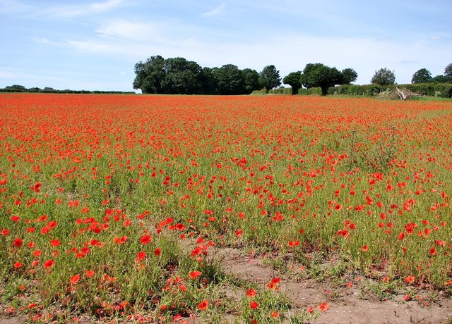
Poppies galore at Keswick
An application to turn farmland situated in a triangle between the A140 near Harford Bridge Tesco and the B1113 into offices, industrial units and warehouses had been rejected in the summer of 2017. People living in Keswick as well as Keswick and Intwood Parish Council, Caistor St Edmund Parish Council and Cringleford Parish Council all objected to the proposal and the scheme was turned down by South Norfolk Council on the grounds of harm to the landscape, but the applicant (MAHB) returned with a revised application which would take up an even bigger space. There is as yet no decision and the crop field concerned has since been left untilled. Many people are currentl driving to the location especially to admire and photograph the riot of poppies which has sprung up here.
Update: Norwich Apex Limited had been given outline planning permission to turn the field into an industrial development back in 2018, a project it hoped would create around 1,000 new jobs in the county. The field makes up the main part of the site, which is said to provide more than 300,000 square metres of employment space. Craig Knights, one of the company's directors, said that the decision to allow the poppies to grow had been deliberate. (Eastern Daily Press, 25 June 2020)
Update: Norwich Apex Limited had been given outline planning permission to turn the field into an industrial development back in 2018, a project it hoped would create around 1,000 new jobs in the county. The field makes up the main part of the site, which is said to provide more than 300,000 square metres of employment space. Craig Knights, one of the company's directors, said that the decision to allow the poppies to grow had been deliberate. (Eastern Daily Press, 25 June 2020)
 Map © Crown Copyright")
TIP: Click the map for more Large scale mapping
- Grid Square
- TG2104, 114 images (more nearby 🔍)
- Photographer
- Evelyn Simak (more nearby)
- Date Taken
- Monday, 22 June, 2020 (more nearby)
- Submitted
- Monday, 22 June, 2020
- Subject Location
-
OSGB36:
 TG 2156 0457 [10m precision]
WGS84: 52:35.6242N 1:16.1846E - Camera Location
-
OSGB36: TG 2178 0465
- View Direction
- West-southwest (about 247 degrees)