2018
HU3630 : West Burra tombolo
taken 6 years ago, near to Papil, West Burra, Shetland Islands, Scotland
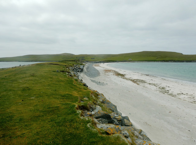
West Burra tombolo
Having started at Bridge End on West Burra, paddling down South Voe and West Voe, we knew we would be exposed to the swell at the south end when we wanted to cross over in our sea kayak circumnavigation of East Burra. So we'd stopped at this tombolo hoping it would offer us a view of sea conditions to the west. It turned out that Banna Minn has a sufficiently narrow entrance that it is quite a sheltered beach, so we left not much better informed than when we'd landed. And, yes, paddling round the south end of East Burra did indeed prove quite exciting...
 Map © Crown Copyright")
TIP: Click the map for more Large scale mapping
- Grid Square
- HU3630, 67 images (more nearby 🔍)
- Photographer
- Andy Waddington (more nearby)
- Date Taken
- Sunday, 24 June, 2018 (more nearby)
- Submitted
- Thursday, 25 June, 2020
- Subject Location
-
OSGB36:
 HU 3645 3048 [10m precision]
WGS84: 60:3.4451N 1:20.8314W - Camera Location
-
OSGB36: HU 3663 3059
- View Direction
- West-southwest (about 247 degrees)