Geograph - photograph every grid square
2011
TQ6974
: Shorne Marshes
taken
13 years ago
,
near
to
Chalk
, Kent, England
This is 1 of
4 images, with title Shorne Marshes
in this square
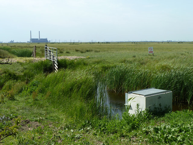
Shorne Marshes
The part in a firing range.
© Copyright
Robin Webster
and licensed for
reuse
under this
Creative Commons Licence
.
Licensing
Download
More Sizes
Share...
Share this photo via Twitter
Share this photo via Facebook
Share this photo via Pinterest
Share this photo via Flipboard
Share this photo via email/e-card
Grab a Stamped/Watermarked Image
Mark
👍🏻
Like Image
👍🏻
Like Description
Update Information
Contact Contributor
Geographical Context:
Lakes, Wetland, Bog
TIP: Click the map for more Large scale mapping
Grid Square
TQ6974
, 107 images (
more nearby
🔍
)
Photographer
Robin Webster
(
more nearby
)
Date Taken
Monday, 27 June, 2011 (
more nearby
)
Submitted
Saturday, 27 June, 2020
Subject Location
OSGB36:
TQ 6934 7417
[10m precision]
WGS84:
51:26.4726N
0:26.1107E
Camera Location
OSGB36:
TQ 69495 74116
View Direction
West-northwest (about 292 degrees)
NW
N
NE
W
Go
E
SW
S
SE
Discuss TQ6974
View this location on ...
Geograph Coverage Map (includes OSM etc)
Geograph Links Page
Open in Google Maps
Navigate to location with Google Maps
Open in Google Earth Pro
Open in Google Earth for Web
Open in Bing Maps
Navigate with Google Maps
Lookup nearest Postcode
Image Type
(about)
:
geograph
This page has been
viewed
about
14
times
☰
Home
View
Search
Marked Images
Maps
Browser
Explore
Showcase
New Images
Collections
Interact
Games
Discussions
Blog
Contributors
Submit
Statistics
Leaderboards
General
FAQ
Help Pages
Sitemap
Contact Us
Support Us
sponsored by
🔍
What to search:
Photos
Enter keywords or a location/postcode to search nearby images
Photos near TQ6974
Enter a Grid Reference
Placenames
Collections
Website Pages
Everything
Others:
Advanced Search
|
Image Browser
Or:
Coverage Map
|
Searchable Map
You are not logged in
login
|
register