2020
SO3958 : Path to Pembridge Village Green Conservation Area
taken 4 years ago, near to Pembridge, County of Herefordshire, England
This is 1 of 2 images, with title Path to Pembridge Village Green Conservation Area in this square
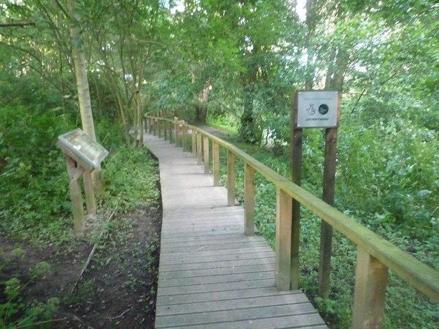
Path to Pembridge Village Green Conservation Area
The conservation area and path leading to it were set up in 2009, and this was lottery funded. The path is placed near the River Arrow, which is out of shot to the right.
 Map © Crown Copyright")
TIP: Click the map for more Large scale mapping
- Grid Square
- SO3958, 554 images (more nearby 🔍)
- Photographer
- Fabian Musto (more nearby)
- Date Taken
- Saturday, 27 June, 2020 (more nearby)
- Submitted
- Monday, 29 June, 2020
- Subject Location
-
OSGB36:
 SO 3912 5849 [10m precision]
WGS84: 52:13.2743N 2:53.5567W - Camera Location
-
OSGB36: SO 3912 5849
- View Direction
- EAST (about 90 degrees)