2003
NN4838 : Moorland with rocks from summit of Meall Taurnaigh
taken 21 years ago, 3 km from Kenknock, Stirling, Scotland
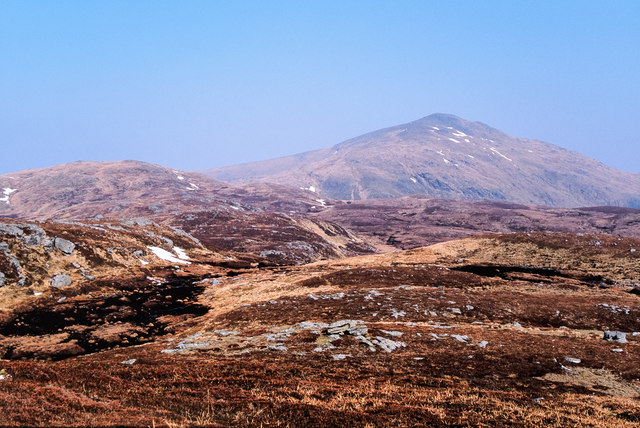
Moorland with rocks from summit of Meall Taurnaigh
Meall Taurnaigh is a relatively minor top along the hill chain connection Meall nan Subh and Meall Ghaordaidh, which is the mountain cone in the distance. Meall na Cnap Làraich is the intermediate top to the left in the image.
(From a copied, Fujichrome transparency.)
(From a copied, Fujichrome transparency.)
 Map © Crown Copyright")
TIP: Click the map for more Large scale mapping
- Grid Square
- NN4838, 11 images (more nearby 🔍)
- Photographer
- Trevor Littlewood (more nearby)
- Date Taken
- Monday, 24 March, 2003 (more nearby)
- Submitted
- Monday, 29 June, 2020
- Subject Location
-
OSGB36:
 NN 489 387 [100m precision]
WGS84: 56:30.9821N 4:27.4142W - Camera Location
-
OSGB36: NN 487 386
- View Direction
- East-northeast (about 67 degrees)