SO7711 : Gloucester & Sharpness Canal mile peg
taken 5 years ago, near to Longney, Gloucestershire, England
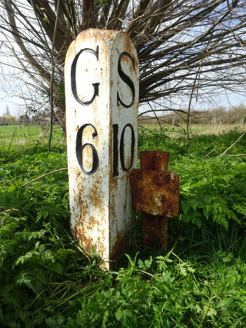
Milestone Society National ID: GSC-06
Mr Red's more complete lists of: - audio stories by local people about canals Link
Gloucester & Sharpness canal mile pegs .. Link- Thames & Severn canal milestones ........ Link
OS Benchmarks along the T&S canal ....... Link
These images are from Link
The Gloucester and Sharpness Ship Canal was built in order that vessels could bypass a particular hazardous and meandering stretch of the tidal River Severn. The canal was started in 1794, then continued in 1817 following consultation with Thomas Telford. Further delays meant the canal was not fully navigable until 1827.
Maximum dimensions for vessels: Length 240 feet, beam 30 feet, draught 10 feet, and headroom 105 feet. On this canal there is a speed limit of 6 mph. The canal is 16½ miles long, with a lock to the River Severn at each end.
 Map © Crown Copyright")
- Grid Square
- SO7711, 8 images (more nearby 🔍)
- Photographer
- Mr Red (more nearby)
- Date Taken
- Wednesday, 27 March, 2019 (more nearby)
- Submitted
- Tuesday, 30 June, 2020
- Subject Location
-
OSGB36:
 SO 77897 11130 [1m precision]
WGS84: 51:47.9025N 2:19.3152W - Camera Location
-
OSGB36: SO 77897 11130
- View Direction
- West-northwest (about 292 degrees)