2019
SN6863 : Dyke along the cut section of the Afon Teifi, Cors Caron
taken 5 years ago, 3 km from Swyddffynnon, Ceredigion/Sir Ceredigion, Wales
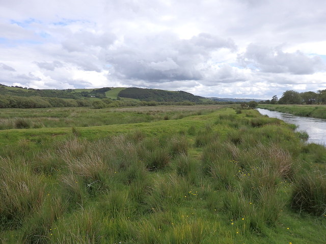
Dyke along the cut section of the Afon Teifi, Cors Caron
A cut has been dug in the river to dry up the old meandering river bed and the left bank has been dyked in the past in order to protect the peat digs to the east (left). The old river bed can be seen in the bog on the left and is very evident in the satellite image.
 Map © Crown Copyright")
TIP: Click the map for more Large scale mapping
- Grid Square
- SN6863, 82 images (more nearby 🔍)
- Photographer
- Rudi Winter (more nearby)
- Date Taken
- Saturday, 8 June, 2019 (more nearby)
- Submitted
- Sunday, 5 July, 2020
- Subject Location
-
OSGB36:
 SN 6870 6309 [10m precision]
WGS84: 52:15.0165N 3:55.4870W - Camera Location
-
OSGB36: SN 6877 6332
- View Direction
- South-southwest (about 202 degrees)