2020
SO5011 : Disused field gate at the southern edge of Monmouth
taken 4 years ago, near to Monmouth/Trefynwy, Monmouthshire/Sir Fynwy, Wales
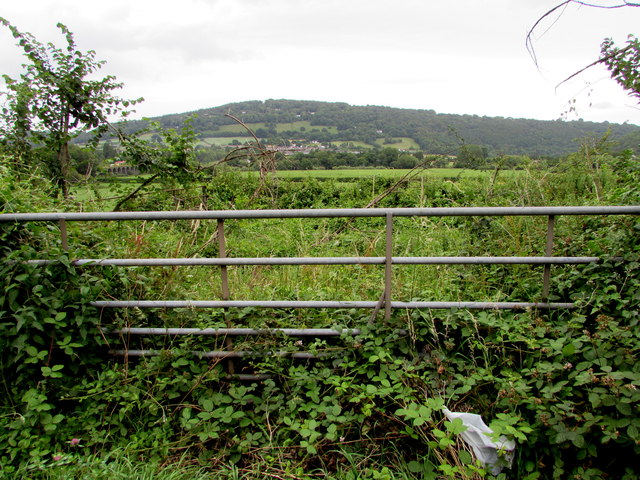
Disused field gate at the southern edge of Monmouth
In July 2020 the growth of weeds on the east side of the B4293 shows that the gate has not been used recently.
A June 2019 Google Street View shows a similar scene.
A June 2019 Google Street View shows a similar scene.
 Map © Crown Copyright")
TIP: Click the map for more Large scale mapping
- Grid Square
- SO5011, 90 images (more nearby 🔍)
- Photographer
- Jaggery (more nearby)
- Date Taken
- Tuesday, 7 July, 2020 (more nearby)
- Submitted
- Wednesday, 8 July, 2020
- Subject Location
-
OSGB36:
 SO 5089 1169 [10m precision]
WGS84: 51:48.1011N 2:42.8163W - Camera Location
-
OSGB36: SO 5089 1169
- View Direction
- EAST (about 90 degrees)