2008
TG1630 : The former Blickling Watermill
taken 16 years ago, near to Itteringham, Norfolk, England
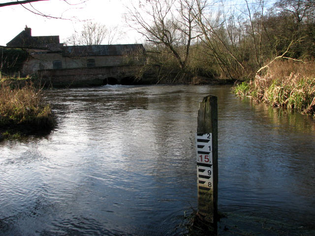
The former Blickling Watermill
Blickling Mill once belonged to the Blickling Estate, presently owned by the National Trust. The mill house was extended during the 1820s, and again in 1860; the mill was three storeys high. Production ceased around 1914 and in 1979 the Anglian Water Authority proposed plans for the erection of a water gauging station, a project that appears to have been abandoned again. Link
 Map © Crown Copyright")
TIP: Click the map for more Large scale mapping
- Grid Square
- TG1630, 21 images (more nearby 🔍)
- Photographer
- Evelyn Simak (more nearby)
- Date Taken
- Wednesday, 9 January, 2008 (more nearby)
- Submitted
- Wednesday, 9 January, 2008
- Subject Location
-
OSGB36:
 TG 163 304 [100m precision]
WGS84: 52:49.6875N 1:12.5894E - Camera Location
-
OSGB36: TG 164 304
- View Direction
- WEST (about 270 degrees)