2020
TA1166 : Arable crop at the top of Thornholme Field
taken 4 years ago, near to Thornholme, East Riding of Yorkshire, England
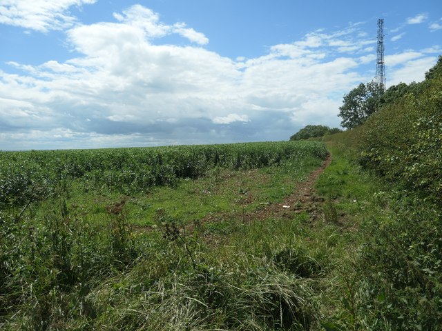
Arable crop at the top of Thornholme Field
Beans, I think. The large field [now subdivided] runs up the Yorkshire Wolds escarpment from the village of Thornholme, which is over 2 kms away and 60 metres lower.
 Map © Crown Copyright")
TIP: Click the map for more Large scale mapping
- Grid Square
- TA1166, 72 images (more nearby 🔍)
- Photographer
- Christine Johnstone (more nearby)
- Date Taken
- Monday, 6 July, 2020 (more nearby)
- Submitted
- Thursday, 16 July, 2020
- Subject Location
-
OSGB36:
 TA 1122 6615 [10m precision]
WGS84: 54:4.7562N 0:18.0902W - Camera Location
-
OSGB36: TA 1125 6617
- View Direction
- Southwest (about 225 degrees)