2017
SD9927 : Benchmark on wall fronting Nutclough Cottage
taken 7 years ago, near to Hebden Bridge, Calderdale, England
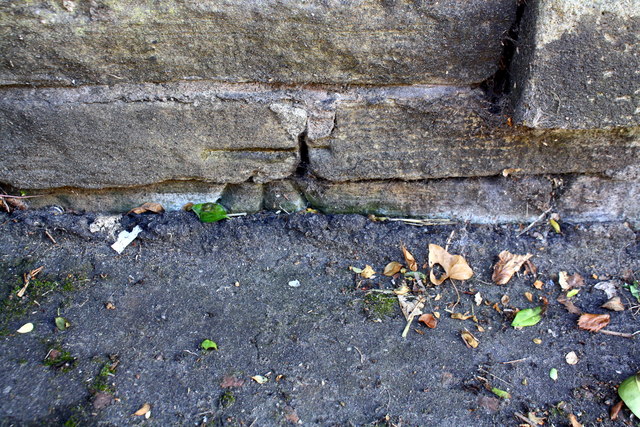
Benchmark on wall fronting Nutclough Cottage
Ordnance Survey cut mark benchmark described on the Bench Mark Database at Link
 Map © Crown Copyright")
TIP: Click the map for more Large scale mapping
- Grid Square
- SD9927, 906 images (more nearby 🔍)
- Photographer
- Roger Templeman (more nearby)
- Date Taken
- Saturday, 12 August, 2017 (more nearby)
- Submitted
- Thursday, 16 July, 2020
- Subject Location
-
OSGB36:
 SD 9947 2751 [10m precision]
WGS84: 53:44.6380N 2:0.5709W - Camera Location
-
OSGB36: SD 9947 2751
- View Direction
- Southeast (about 135 degrees)