2017
SD7862 : Benchmark on stone (stile step) in wall on SW side of Storth Gill Lane
taken 7 years ago, near to Wham, North Yorkshire, England
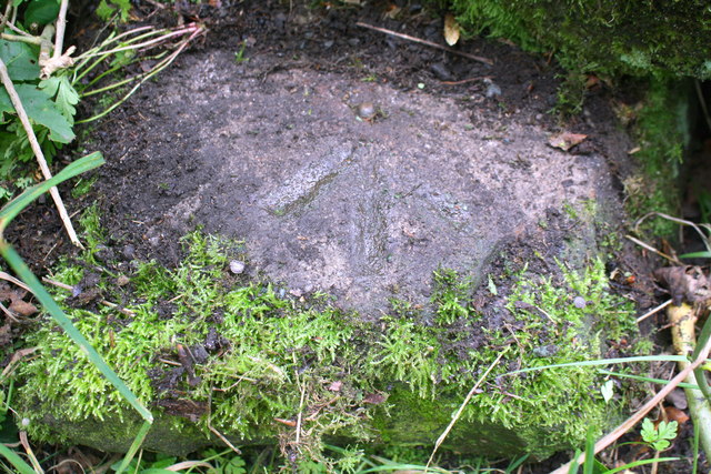
Benchmark on stone (stile step) in wall on SW side of Storth Gill Lane
Ordnance Survey rivet benchmark described on the Bench Mark Database at Link
 Map © Crown Copyright")
TIP: Click the map for more Large scale mapping
- Grid Square
- SD7862, 15 images (more nearby 🔍)
- Photographer
- Roger Templeman (more nearby)
- Contributed by
- Luke Shaw (more nearby)
- Date Taken
- Tuesday, 22 August, 2017 (more nearby)
- Submitted
- Saturday, 18 July, 2020
- Subject Location
-
OSGB36:
 SD 7887 6286 [10m precision]
WGS84: 54:3.6749N 2:19.4585W - Camera Location
-
OSGB36: SD 7887 6286
- View Direction
- Southwest (about 225 degrees)