2017
SD7469 : Benchmark on SE corner of St James's Church
taken 7 years ago, near to Clapham, North Yorkshire, England
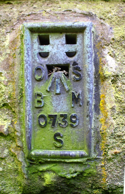
Benchmark on SE corner of St James's Church
Ordnance Survey flush bracket (serial identifier S0739) benchmark described on the Bench Mark Database at Link
 Map © Crown Copyright")
TIP: Click the map for more Large scale mapping
- Grid Square
- SD7469, 316 images (more nearby 🔍)
- Photographer
- Roger Templeman (more nearby)
- Date Taken
- Thursday, 5 October, 2017 (more nearby)
- Submitted
- Friday, 31 July, 2020
- Subject Location
-
OSGB36:
 SD 7459 6943 [10m precision]
WGS84: 54:7.2061N 2:23.4150W - Camera Location
-
OSGB36: SD 7459 6943
- View Direction
- WEST (about 270 degrees)