2020
NT3669 : Carberry from the air
taken 4 years ago, near to Crossgatehall, East Lothian, Scotland
This is 1 of 2 images, with title Carberry from the air in this square
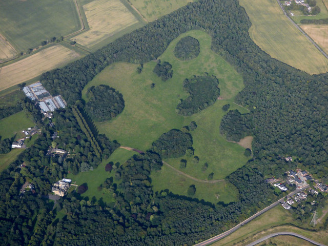
Carberry from the air
The landscaped gardens and parkland around Carberry Tower are designated by Historic Environment Scotland as being of historic and national importance Link .
.
 Map © Crown Copyright")
TIP: Click the map for more Large scale mapping
- Grid Square
- NT3669, 58 images (more nearby 🔍)
- Photographer
- Thomas Nugent (more nearby)
- Date Taken
- Wednesday, 29 July, 2020 (more nearby)
- Submitted
- Tuesday, 4 August, 2020
- Subject Location
-
OSGB36:
 NT 363 692 [100m precision]
WGS84: 55:54.7435N 3:1.1604W - View Direction
- East-northeast (about 67 degrees)