2020
SJ0681 : Ruin beside the Offa's Dyke Path
taken 4 years ago, near to Meliden, Denbighshire/Sir Ddinbych, Wales
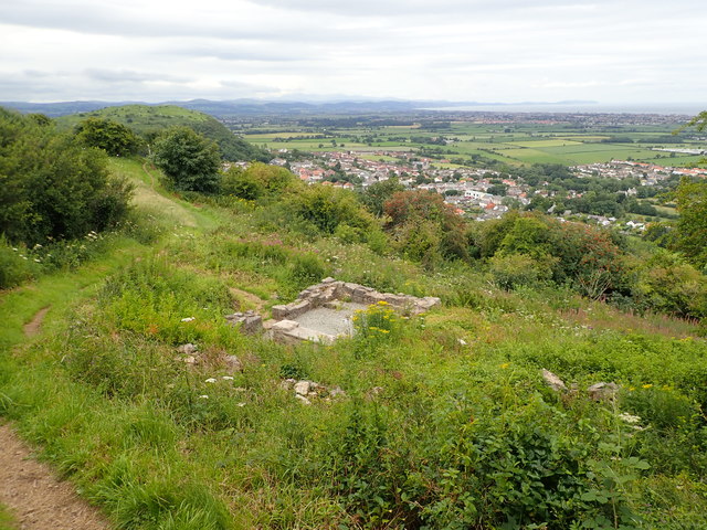
Ruin beside the Offa's Dyke Path
Remains of a house on the hillside north of Meliden
 Map © Crown Copyright")
TIP: Click the map for more Large scale mapping
- Grid Square
- SJ0681, 26 images (more nearby 🔍)
- Photographer
- Eirian Evans (more nearby)
- Date Taken
- Wednesday, 22 July, 2020 (more nearby)
- Submitted
- Monday, 10 August, 2020
- Subject Location
-
OSGB36:
 SJ 068 810 [100m precision]
WGS84: 53:19.0891N 3:23.9954W - Camera Location
-
OSGB36: SJ 068 810
- View Direction
- West-southwest (about 247 degrees)