2020
SO9674 : Milepost, Lower Marlbrook
taken 4 years ago, near to Upper Catshill, Worcestershire, England
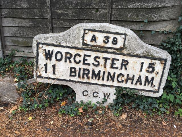
Milepost, Lower Marlbrook
Metal plate attached to concrete post by the A38, in parish of Lickey (Bromsgrove District), Lower Marlbrook, N of M42 Jct 1, in pavement, at end of crash barrier, back to wooden fence, on East side of road. Bradley post erected by the County Council in the 20th century.
Inscription reads: // A38 / WORCESTER 15. / 11 BIRMINGHAM. / C.C.W. //
Not listed by Historic England. NGR: SO 96922 74253
Milestone Society National ID: WO_WOBM15
Inscription reads: // A38 / WORCESTER 15. / 11 BIRMINGHAM. / C.C.W. //
Not listed by Historic England. NGR: SO 96922 74253
Milestone Society National ID: WO_WOBM15
National Survey of Wayside Features by The Milestone Society
These images are from Link
 Map © Crown Copyright")
TIP: Click the map for more Large scale mapping
- Grid Square
- SO9674, 49 images (more nearby 🔍)
- Photographer
- Jan Scrine (more nearby)
- Contributed by
- Mike Faherty (more nearby)
- Date Taken
- Thursday, 13 August, 2020 (more nearby)
- Submitted
- Tuesday, 25 August, 2020
- Subject Location
-
OSGB36:
 SO 9692 7425 [10m precision]
WGS84: 52:21.9775N 2:2.7995W - Camera Location
-
OSGB36: SO 9692 7425
- View Direction
- EAST (about 90 degrees)