SY6790 : Bridport Road, Poundbury
taken 4 years ago, near to Poundbury, Dorset, England
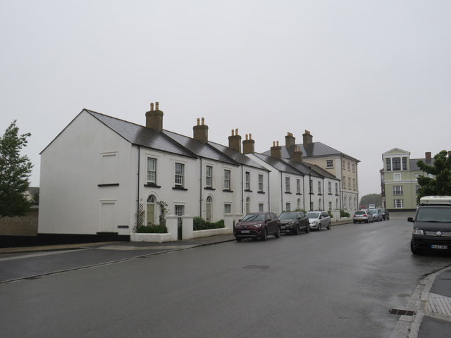
Bridport Road follows the course of a Roman road. It also formed part of the route of the trunk A35 road for a time, until Dorchester by-pass was built. Despite their traditional appearance, these cottages are from a more recent time, as Poundbury has been developed from the 1990s onwards.
Poundbury is the urban extension to Dorchester in Dorset, and is famous internationally as a pioneering example of urban development.
It seeks to implement the principles expounded in The Prince of Waless 1989 book, A Vision of Britain.
It is the result of The Princes belief on town-planning coupled with a long period of public consultation between 1988 and 1993. Poundbury is expected to be fully completed by 2025 when it will add approximately 5,000 to the population of Dorchester with 2,000 jobs in the factories, offices and general facilities across the site.
Poundbury is being built in a number of different phases to allow for a more gradual extension of Dorchester. The first phase, covering 7.5 hectares, was completed in 2002 and Phase 2, covering 13.5 hectares, is due for completion by December 2006.
The emerging local plan for West Dorset allocates the balance of Poundbury (approx. 40 hectares) for development over the next 15 to 20 years. This will be to the north of Phase 2 and principally residential, although sites for employment and retail uses, a leisure centre and new Pre-School have been reserved. To the east of these developments will be a park, the first element of which will be landscaped in 2006.
[Extract Duchy of Cornwall Link]
 Map © Crown Copyright")
- Grid Square
- SY6790, 223 images (more nearby 🔍)
- Photographer
- Malc McDonald (more nearby)
- Date Taken
- Wednesday, 19 August, 2020 (more nearby)
- Submitted
- Sunday, 6 September, 2020
- Subject Location
-
OSGB36:
 SY 6705 9039 [10m precision]
WGS84: 50:42.7321N 2:28.0828W - Camera Location
-
OSGB36: SY 6707 9040
- View Direction
- West-southwest (about 247 degrees)