2020
SJ8625 : WWII Staffordshire: RAF Seighford - Watch Office/Control Tower (1)
taken 4 years ago, near to Ranton, Staffordshire, England
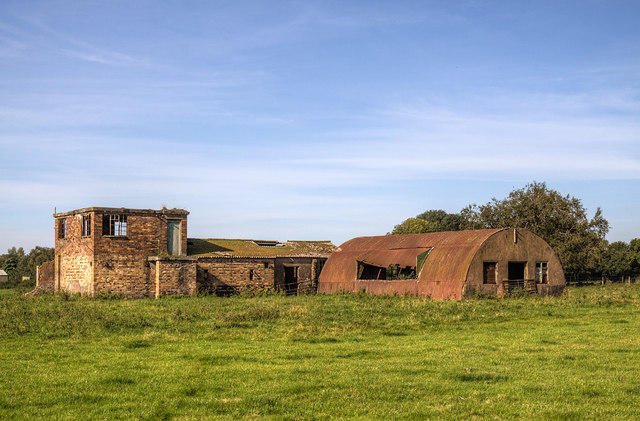
WWII Staffordshire: RAF Seighford - Watch Office/Control Tower (1)
The control tower and ancillary buildings at the former RAF Seighford.
History:
Opened in January 1943 as a satellite airfield to RAF Hixon, it was used mainly for training aircrew becoming home to 30 OTU (Operational Training Unit) and 21 Pilots AFU (Advanced Flying Unit) who operated with Airspeed Oxfords. In particular 30 OTU's Vickers Wellington twin-engined bombers were a common sight on the airfield, as on occasion were B-17 Flying Fortresses of the USAAF, who would sometimes divert here in bad weather. The airfield was also used by 23 HGCU (Heavy Glider Conversion Unit) training glider pilots. At the end of the war repatriated prisoners of war were landed at Seighford, and whilst military flying ceased in 1946, from 1956-1966 Boulton and Paul Ltd used part of the airfield for testing jet aircraft.
SJ8625 : WWII Staffordshire: RAF Seighford - Watch Office/Control Tower (2)
 Map © Crown Copyright")
TIP: Click the map for more Large scale mapping
- Grid Square
- SJ8625, 34 images (more nearby 🔍)
- Photographer
- Mike Searle (more nearby)
- Date Taken
- Monday, 14 September, 2020 (more nearby)
- Submitted
- Friday, 25 September, 2020
- Subject Location
-
OSGB36:
 SJ 8628 2572 [10m precision]
WGS84: 52:49.7296N 2:12.3043W - Camera Location
-
OSGB36: SJ 8627 2576
- View Direction
- SOUTH (about 180 degrees)