2020
SD5185 : Benchmark, Tunnel Lane Railway Bridge
taken 4 years ago, near to Hincaster, Cumbria, England
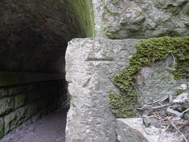
Benchmark, Tunnel Lane Railway Bridge
Detail of the Ordnance Survey cut benchmark on the south abutment of Tunnel Lane Railway Bridge. The benchmark marks a height of 52.786m above mean sea level (Ordnance Datum Newlyn) last verified in 1970 (location photograph SD5185 : Tunnel Lane Railway Bridge abutment).
Tunnel Lane carries the towpath of the Lancaster Canal over Hincaster Tunnel.
Tunnel Lane carries the towpath of the Lancaster Canal over Hincaster Tunnel.
 Map © Crown Copyright")
TIP: Click the map for more Large scale mapping
- Grid Square
- SD5185, 65 images (more nearby 🔍)
- Photographer
- Adrian Taylor (more nearby)
- Date Taken
- Monday, 8 June, 2020 (more nearby)
- Submitted
- Friday, 9 October, 2020
- Subject Location
-
OSGB36:
 SD 5124 8510 [10m precision]
WGS84: 54:15.5539N 2:45.0005W - Camera Location
-
OSGB36: SD 5124 8510
- View Direction
- EAST (about 90 degrees)