2020
NJ4453 : Burnside Farm
taken 4 years ago, near to Glen of Newmill, Moray, Scotland
This is 1 of 3 images, with title Burnside Farm in this square
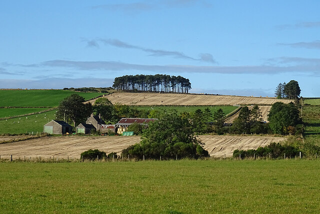
Burnside Farm
Comparing this with the first edition of the six-inch Ordnance Survey map the layout and boundaries of the fields at Burnside have not changed in 170 years or so.
 Map © Crown Copyright")
TIP: Click the map for more Large scale mapping
- Grid Square
- NJ4453, 16 images (more nearby 🔍)
- Photographer
- Anne Burgess (more nearby)
- Date Taken
- Thursday, 8 October, 2020 (more nearby)
- Submitted
- Sunday, 11 October, 2020
- Subject Location
-
OSGB36:
 NJ 4406 5367 [10m precision]
WGS84: 57:34.1773N 2:56.2102W - Camera Location
-
OSGB36: NJ 4444 5381
- View Direction
- West-southwest (about 247 degrees)