2020
NY5709 : Navigation hazard in Wasdale Beck
taken 4 years ago, 4 km NW of Greenholme, Cumbria, England
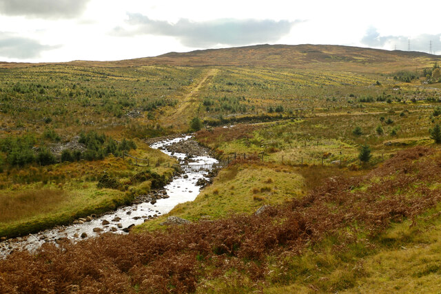
Navigation hazard in Wasdale Beck
A spate run, Wasdale Beck in high water is an alpine-style grade 4-5 descent taking maybe an hour (with minimal inspection) from the A6 down to the Shap Wells Hotel. Needless to say it needs a lot of water and doesn't stay up very long. Seen here after some rain (the fells were pretty boggy underfoot) but with nowhere near enough to paddle, the sheep fence across the stream looks easy to avoid. When bank full, eddies vanish and man-made features like this pose a real risk to life (and could be construed as illegal obstruction of the right of navigation). There's a low footbridge upstream where the beck is steeper, as well as more livestock fences, so a strong (but small) team is needed to paddle it safely. However, the recent clear cutting has at least reduced the potential for trees in the water,
 Map © Crown Copyright")
TIP: Click the map for more Large scale mapping
- Grid Square
- NY5709, 41 images (more nearby 🔍)
- Photographer
- Andy Waddington (more nearby)
- Date Taken
- Sunday, 11 October, 2020 (more nearby)
- Submitted
- Tuesday, 13 October, 2020
- Subject Location
-
OSGB36:
 NY 5746 0914 [10m precision]
WGS84: 54:28.5494N 2:39.4787W - Camera Location
-
OSGB36: NY 5751 0925
- View Direction
- South-southwest (about 202 degrees)