2008
NG1552 : Above the waterfall at Guala Mhor
taken 16 years ago, near to Lower Milovaig, Isle of Skye, Scotland
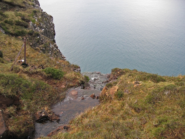
Above the waterfall at Guala Mhor
The waterfall, marked on the 25k OS map, is where the burn goes over the edge of the cliff here and falls 120m to the sea.
 Map © Crown Copyright")
TIP: Click the map for more Large scale mapping
- Grid Square
- NG1552, 6 images (more nearby 🔍)
- Photographer
- John Allan (more nearby)
- Date Taken
- Monday, 21 January, 2008 (more nearby)
- Submitted
- Monday, 21 January, 2008
- Subject Location
-
OSGB36:
 NG 156 526 [100m precision]
WGS84: 57:28.4878N 6:44.7402W - Camera Location
-
OSGB36: NG 156 526
- View Direction
- WEST (about 270 degrees)