TQ3583 : Narrowboat, Regent's Canal
taken 5 years ago, near to Bethnal Green, Tower Hamlets, England
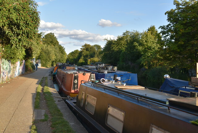
A Narrowboat is a long thin boat, designed to fit the canals of England and Wales. They were 7 feet (2.1 metres) wide, and up to 70 feet (21 metres) in length, the maximum that will fit in a standard lock.
In the 18th century before the age of steam railways and the internal combustion engines, the canals were one of the key systems of transporting goods around the country. The boats were towed by a shire horse walking along the tow-path. Of course boats today are powered by diesel engines.
Most narrowboats today are used for holidays & leisure cruising, and some are used as homes.
Read more at wikipedia Link
The Regent's Canal is a nine-mile man-made stretch of water connecting the Grand Union Canal at Little Venice to the River Thames. The first section of the canal from Little Venice was opened in 1816 and the final section at Limehouse Basin in 1820. The canal has 13 sets of locks.
 Map © Crown Copyright")
- Grid Square
- TQ3583, 408 images (more nearby 🔍)
- Photographer
- N Chadwick (more nearby)
- Date Taken
- Saturday, 7 September, 2019 (more nearby)
- Submitted
- Saturday, 17 October, 2020
- Subject Location
-
OSGB36:
 TQ 3513 8358 [10m precision]
WGS84: 51:32.0976N 0:3.1869W - Camera Location
-
OSGB36: TQ 3512 8359
- View Direction
- East-southeast (about 112 degrees)