2020
NT9517 : Valley of the Linhope Burn
taken 3 years ago, near to Linhope, Northumberland, England
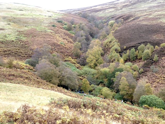
Valley of the Linhope Burn
Looking down into the valley of the Linhope Burn with the valley of the Dunmoor Burn opposite. The famous waterfall of Linhope Spout is in the trees to the left; some of the crowd of people who have come out to view the fall can be seen in the floor of the valley. The woods and moors are displaying beautiful autumn colours.
 Map © Crown Copyright")
TIP: Click the map for more Large scale mapping
- Grid Square
- NT9517, 56 images (more nearby 🔍)
- Photographer
- Oliver Dixon (more nearby)
- Date Taken
- Sunday, 18 October, 2020 (more nearby)
- Submitted
- Monday, 19 October, 2020
- Subject Location
-
OSGB36:
 NT 9584 1709 [10m precision]
WGS84: 55:26.8595N 2:4.0390W - Camera Location
-
OSGB36: NT 95852 16944
- View Direction
- NORTH (about 0 degrees)