TF6219 : Greyfriars Tower
taken 5 years ago, near to King's Lynn, Norfolk, England
Grade I listed buildings and structures are of exceptional, even international importance. There are over 6,000 in the country. Only 2.5% of listed buildings are Grade I listed.
In Scotland the classification is Category A
Index: Link
In the United Kingdom, a scheduled monument is a 'nationally important' archaeological site or historic building, given protection against unauthorised change.
There are about 20,000 scheduled monuments in England representing about 37,000 heritage assets. Of the tens of thousands of scheduled monuments in the UK, most are inconspicuous archaeological sites, but some are large ruins.
Wikipedia: Link
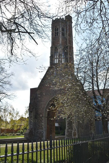
Greyfriars, King's Lynn was a Franciscan friary in Norfolk, England. The tower, known as Greyfriars Tower survives. It is one of only three surviving Franciscan monastery towers in England and is considered to be the finest. It is a Grade I listed building.Link
Following the Dissolution of the Monasteries by Henry VIII, the tower at Lynn remained because it was considered to be a useful seamark by sailors entering the town, still being clearly visible on the town's skyline to this day.
The tower is informally referred to as 'the leaning tower of Lynn' as it leans dramatically to the west. At its worst, the lean was 67.5 centimetres - which given its height of more than 28 metres is just over 1 degree.
 Map © Crown Copyright")
- Grid Square
- TF6219, 427 images (more nearby 🔍)
- Photographer
- N Chadwick (more nearby)
- Date Taken
- Saturday, 13 April, 2019 (more nearby)
- Submitted
- Monday, 19 October, 2020
- Subject Location
-
OSGB36:
 TF 6201 1978 [10m precision]
WGS84: 52:45.0811N 0:23.9396E - Camera Location
-
OSGB36: TF 6203 1980
- View Direction
- Southwest (about 225 degrees)