2020
TR2667 : Lane through Farmland
taken 3 years ago, near to St Nicholas at Wade, Kent, England
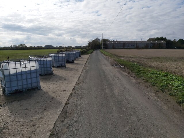
Lane through Farmland
A view of Shuart Lane past a ploughed field looking towards Bramble Lodge in an area called St Nicholas at Wade Country Park. Also a public right of way.
 Map © Crown Copyright")
TIP: Click the map for more Large scale mapping
- Grid Square
- TR2667, 19 images (more nearby 🔍)
- Photographer
- John P Reeves (more nearby)
- Date Taken
- Sunday, 18 October, 2020 (more nearby)
- Submitted
- Tuesday, 20 October, 2020
- Subject Location
-
OSGB36:
 TR 2675 6744 [10m precision]
WGS84: 51:21.6448N 1:15.3407E - Camera Location
-
OSGB36: TR 2677 6752
- View Direction
- South-southwest (about 202 degrees)