2019
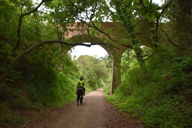
SZ5581 : Bridge over former railway line
taken 5 years ago, near to Whiteley Bank, Isle of Wight, England
This is 1 of 2 images, with title Bridge over former railway line in this square
Bridge over former railway line
Apse Bank is a steep 1:70 gradient on the former railway line.
Isle of Wight Line (disused)
The present day Island Line terminates at Shanklin, but originally reached Ventnor. The line reached Ventnor in 1866 and remained open until 1966. The line is now disused between Shanklin and Ventnor. The section from Shanklin to Wroxall is used for National Cycle Route 23. Between Wroxall and Ventnor was the 1200m long St Boniface Down tunnel.
National Cycle Network route 23
National Cycle Network route 23 is a north-south route linking Reading, Basingstoke, Winchester and Southampton. There is a further section on the Isle of Wight from the ferry terminal at East Cowes to Wroxall, passing through Cowes, Newport and Shanklin. The Isle of Wight section forms part of the Red Squirrel Trail.
More information on Sustrans' website: Link
 Map © Crown Copyright")
TIP: Click the map for more Large scale mapping
- Grid Square
- SZ5581, 28 images (more nearby 🔍)
- Photographer
- N Chadwick (more nearby)
- Date Taken
- Wednesday, 29 May, 2019 (more nearby)
- Submitted
- Wednesday, 21 October, 2020
- Subject Location
-
OSGB36:
 SZ 5576 8138 [10m precision]
WGS84: 50:37.7677N 1:12.7798W - Camera Location
-
OSGB36: SZ 5569 8136
- View Direction
- East-northeast (about 67 degrees)