2020
NZ1751 : Approaching the crossroads at the Morrison Road Ends
taken 4 years ago, near to Annfield Plain, County Durham, England
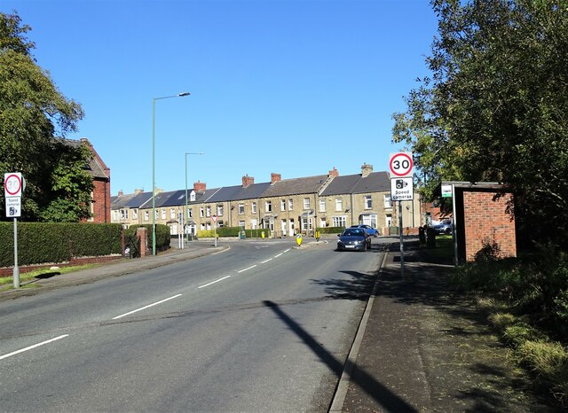
Approaching the crossroads at the Morrison Road Ends
The crossroads takes its local name from the Morrison pit which once stood near here. View is looking along Lanchester Road. The stone terrace of Durham Road dates from late Victorian & Edwardian times.
 Map © Crown Copyright")
TIP: Click the map for more Large scale mapping
- Grid Square
- NZ1751, 30 images (more nearby 🔍)
- Photographer
- Robert Graham (more nearby)
- Date Taken
- Tuesday, 29 September, 2020 (more nearby)
- Submitted
- Tuesday, 27 October, 2020
- Subject Location
-
OSGB36:
 NZ 1729 5127 [10m precision]
WGS84: 54:51.3557N 1:43.9326W - Camera Location
-
OSGB36: NZ 1729 5119
- View Direction
- NORTH (about 0 degrees)