2020
NS3680 : Bromley Muir
taken 4 years ago, near to Alexandria, West Dunbartonshire, Scotland
This is 1 of 2 images, with title Bromley Muir in this square
Bromley Muir
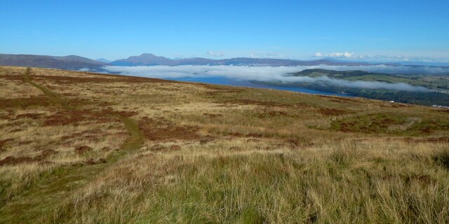
The view is from beside NS3680 : Bromley Muir Trig Point. I waited until the mist that had completely covered Loch Lomond began to lift; it had also covered the valleys of the River Clyde and the River Leven.
The picture also shows a path that runs SSENNW over the muir.
The picture also shows a path that runs SSENNW over the muir.
Loch Lomond
Loch Lomond is the largest lake in Britain. It is 24 miles long and covers 27 square miles. The loch lies along the Highland Boundary Fault.
Wikipedia: Link
 Map © Crown Copyright")
TIP: Click the map for more Large scale mapping
- Grid Square
- NS3680, 67 images (more nearby 🔍)
- Photographer
- Lairich Rig (more nearby)
- Date Taken
- Friday, 2 October, 2020 (more nearby)
- Submitted
- Thursday, 29 October, 2020
- Subject Location
-
OSGB36:
 NS 3687 8058 [10m precision]
WGS84: 55:59.4219N 4:37.0081W - Camera Location
-
OSGB36: NS 3687 8051
- View Direction
- NORTH (about 0 degrees)