2019
NU0016 : Ewe Hill
taken 4 years ago, near to Ingram, Northumberland, England
This is 1 of 3 images, with title Ewe Hill in this square
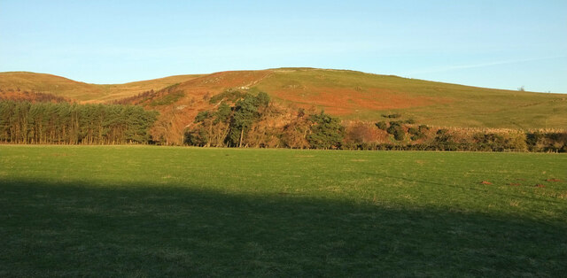
Ewe Hill
Looking right from NU0016 : Road up Breamish valley, across the Breamish flood plain. On the left is Bulby's Wood.
 Map © Crown Copyright")
TIP: Click the map for more Large scale mapping
- Grid Square
- NU0016, 52 images (more nearby 🔍)
- Photographer
- Derek Harper (more nearby)
- Date Taken
- Tuesday, 31 December, 2019 (more nearby)
- Submitted
- Thursday, 29 October, 2020
- Subject Location
-
OSGB36:
 NU 008 167 [100m precision]
WGS84: 55:26.6504N 1:59.3344W - Camera Location
-
OSGB36: NU 0103 1613
- View Direction
- North-northwest (about 337 degrees)