2019

NT9616 : Bridge, Linhope

taken 6 years ago, near to Linhope, Northumberland, England
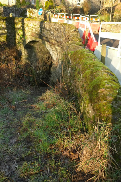
Bridge, Linhope
Bridge, Linhope
Over the Linhope Burn which is flowing to the left. There are bridge works...

Creative Commons Licence [Some Rights Reserved]   © Copyright Derek Harper and licensed for reuse under this Creative Commons Licence.
Geographical Context: Lowlands Paths Boundary, Barrier Rivers, Streams, Drainage Housing, Dwellings Roads, Road transport Construction, Development National Park: Northumberland Stream: Linhope Burn Bridge: Road Over Stream other tags: Barriers House Click a tag, to view other nearby images.
This photo is linked from: Automatic Clusters: · Bridge over Linhope Burn [8] · Bridge Works [3] Other Photos: · Linhope Farmhouse · Linhope Burn ·
1:50,000 Modern Day Landranger(TM) Map © Crown Copyright
+
+
1:50,000 Modern Day Landranger(TM) Map © Crown Copyright
TIP: Click the map for more Large scale mapping
Grid Square
NT9616, 69 images   (more nearby 🔍)
Photographer
Derek Harper   (more nearby)
Date Taken
Tuesday, 31 December, 2019   (more nearby)
Submitted
Monday, 2 November, 2020
Subject Location
OSGB36: geotagged! NT 9639 1623 [10m precision]
WGS84: 55:26.3962N 2:3.5167W
Camera Location
OSGB36: geotagged! NT 9640 1622
View Direction
Northwest (about 315 degrees)
Clickable map
+
NW N NE
W Go E
SW S SE
Image Type (about): geograph 
This page has been viewed about 19 times
You are not logged in | login | register