2020
SD3182 : Footbridge over the river Leven
taken 4 years ago, near to Greenodd, Cumbria, England
This is 1 of 2 images, with title Footbridge over the river Leven in this square
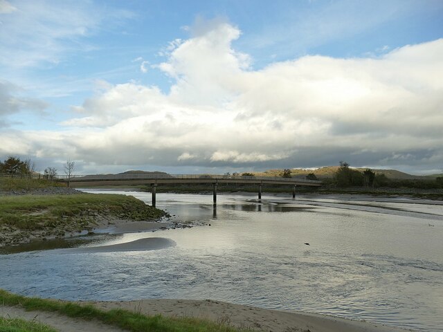
Footbridge over the river Leven
The concrete bridge carries a public footpath, and also the Morecambe Bay Cycleway (though a sign instructs cyclists to dismount and walk their bikes over the narrow bridge). The channel of the Leven used to run west (left) of this view, and where the channel is now, used to be saltmarsh. It was re-engineered in the 1980s when the Greenodd bypass was built using the alignment of a former railway line that used to cross the marsh on an embankment just beyond the present bridge.
 Map © Crown Copyright")
TIP: Click the map for more Large scale mapping
- Grid Square
- SD3182, 87 images (more nearby 🔍)
- Photographer
- Stephen Craven (more nearby)
- Date Taken
- Monday, 12 October, 2020 (more nearby)
- Submitted
- Wednesday, 4 November, 2020
- Subject Location
-
OSGB36:
 SD 3168 8254 [10m precision]
WGS84: 54:14.0392N 3:2.9783W - Camera Location
-
OSGB36: SD 3158 8250
- View Direction
- East-northeast (about 67 degrees)