2020
TQ6378 : Path alongside former playing fields
taken 3 years ago, near to Chadwell st Mary, Thurrock, England
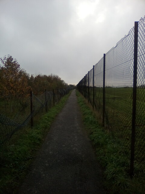
Path alongside former playing fields
A path alongside the high perimeter fence of Thurrock Technical College's playing fields. The college has been demolished and housing erected on the site. Trees had been planted in the grassy area on view here when the houses were built but these have disappeared on quite a grand scale. Broken remnants of the plastic protection given to each sapling is sometimes visible amongst the grass.
 Map © Crown Copyright")
TIP: Click the map for more Large scale mapping
- Grid Square
- TQ6378, 39 images (more nearby 🔍)
- Photographer
- Adrian Benn (more nearby)
- Date Taken
- Monday, 9 November, 2020 (more nearby)
- Submitted
- Monday, 9 November, 2020
- Subject Location
-
OSGB36:
 TQ 6380 7877 [10m precision]
WGS84: 51:29.0499N 0:21.4601E - Camera Location
-
OSGB36: TQ 6385 7908
- View Direction
- SOUTH (about 180 degrees)