2020
SK3606 : Waterlogged track, repaired with bricks
taken 3 years ago, near to Shackerstone, Leicestershire, England
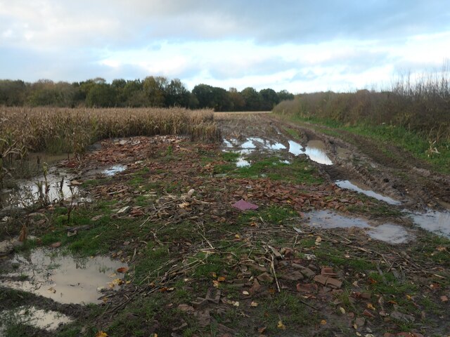
Waterlogged track, repaired with bricks
On the north side of the former avenue to Gopsall Hall. This track is an 'other route with public access'.
 Map © Crown Copyright")
TIP: Click the map for more Large scale mapping
- Grid Square
- SK3606, 12 images (more nearby 🔍)
- Photographer
- Christine Johnstone (more nearby)
- Date Taken
- Saturday, 31 October, 2020 (more nearby)
- Submitted
- Tuesday, 10 November, 2020
- Subject Location
-
OSGB36:
 SK 3631 0655 [10m precision]
WGS84: 52:39.3280N 1:27.8798W - Camera Location
-
OSGB36: SK 3631 0654
- View Direction
- North-northwest (about 337 degrees)