2002
NN5704 : Lochan along Rob Roy Way
taken 22 years ago, 3 km from Port of Menteith, Stirling, Scotland
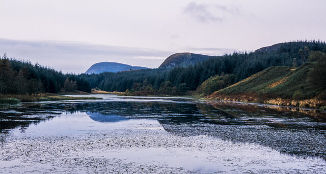
Lochan along Rob Roy Way
An image made in October 2002, long before the notion of a Rob Roy Way had been put into action on the ground. The lochan is un-named on OS Landranger 57 but at the 1:25 000 scale it appears to be named as Allt a' Chip Dhuibh, which is actually the name of the stream flowing into it at the far end and out close to the camera position.
The most distant hill dome is Craig of Monievreckie, highest of the Menteith Hills.
The most distant hill dome is Craig of Monievreckie, highest of the Menteith Hills.
 Map © Crown Copyright")
TIP: Click the map for more Large scale mapping
- Grid Square
- NN5704, 16 images (more nearby 🔍)
- Photographer
- Trevor Littlewood (more nearby)
- Date Taken
- Monday, 7 October, 2002 (more nearby)
- Submitted
- Sunday, 29 November, 2020
- Subject Location
-
OSGB36:
 NN 5721 0407 [10m precision]
WGS84: 56:12.4637N 4:18.2161W - Camera Location
-
OSGB36: NN 5741 0421
- View Direction
- Southwest (about 225 degrees)