2020
NZ0749 : Old farmstead at Wharnley Burn
taken 4 years ago, near to Allensford, County Durham, England
This is 1 of 3 images, with title starting with Old in this square
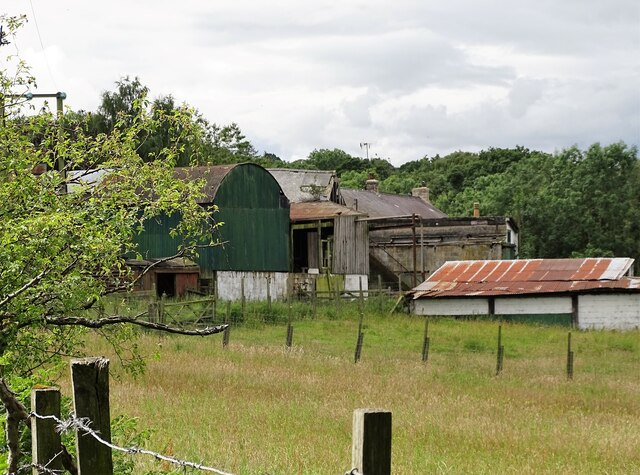
Old farmstead at Wharnley Burn
Nice collection of old barns and sheds from several different periods. The farm here dates back to the 14th century, although the present buildings are probably no older than 18th century. The roof of the house can be seen behind.
 Map © Crown Copyright")
TIP: Click the map for more Large scale mapping
- Grid Square
- NZ0749, 82 images (more nearby 🔍)
- Photographer
- Robert Graham (more nearby)
- Date Taken
- Monday, 6 July, 2020 (more nearby)
- Submitted
- Saturday, 12 December, 2020
- Subject Location
-
OSGB36:
 NZ 0755 4978 [10m precision]
WGS84: 54:50.5667N 1:53.0377W - Camera Location
-
OSGB36: NZ 0764 4986
- View Direction
- Southwest (about 225 degrees)