2020
SE2037 : Sign for Calverley Gate
taken 3 years ago, near to Calverley, Leeds, England
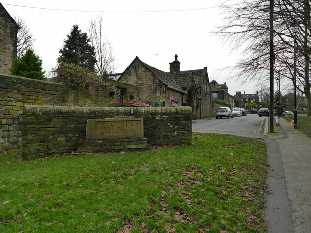
Sign for Calverley Gate
This is the old alignment of Carr Road, which used to have a sharp right angle bend outside the parish church but has been realigned to suit contemporary traffic volumes at the 30mph speed limit.
 Map © Crown Copyright")
TIP: Click the map for more Large scale mapping
- Grid Square
- SE2037, 220 images (more nearby 🔍)
- Photographer
- Stephen Craven (more nearby)
- Date Taken
- Saturday, 26 December, 2020 (more nearby)
- Submitted
- Sunday, 27 December, 2020
- Subject Location
-
OSGB36:
 SE 2073 3713 [10m precision]
WGS84: 53:49.8014N 1:41.1914W - Camera Location
-
OSGB36: SE 2074 3713
- View Direction
- West-southwest (about 247 degrees)