1997
SS1244 : Path to the Old Battery - Lundy Island
taken 27 years ago, near to Lundy, Devon, England
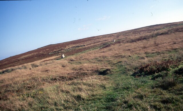
Path to the Old Battery - Lundy Island
Here on the open moorland of Lundy's west coast is the path, with marker stones, which leads from the village across Ackland's (also Acland's) Moor and down to Battery Point. Two families lived in the cottages here and when fog shrouded the island the brace of cannon here would be fired at intervals as an audible warning to shipping. Time photo taken not available.
 Map © Crown Copyright")
TIP: Click the map for more Large scale mapping
- Grid Square
- SS1244, 31 images (more nearby 🔍)
- Photographer
- Martin Richard Phelan (more nearby)
- Date Taken
- September 1997 (more nearby)
- Submitted
- Wednesday, 6 January, 2021
- Subject Location
-
OSGB36:
 SS 1296 4486 [10m precision]
WGS84: 51:10.3388N 4:40.6184W - Camera Location
-
OSGB36: SS 1293 4487
- View Direction
- EAST (about 90 degrees)