2019
NU1341 : Lindisfarne Castle
taken 5 years ago, near to Holy Island, Northumberland, England
This is 1 of 139 images, with title Lindisfarne Castle in this square
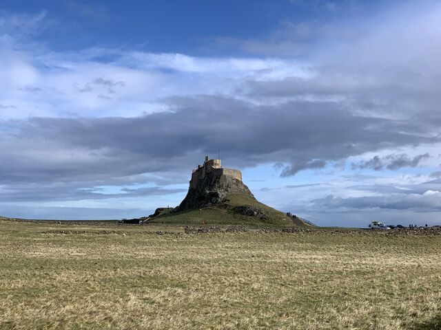
Lindisfarne Castle
This 16th-century converted castle is Grade I listed, see Link
Lindisfarne Castle
Lindisfarne Castle sits on a rocky crag created by a dyke associated with the intrusion of the Whin Sill. Originally a Tudor fort, it was converted into a private house in 1903 by the young Edwin Lutyens. Now managed by the National Trust.
Grade I and Category A listed buildings and structures
Grade I listed buildings and structures are of exceptional, even international importance. There are over 6,000 in the country. Only 2.5% of listed buildings are Grade I listed.
In Scotland the classification is Category A
Index: Link
 Map © Crown Copyright")
TIP: Click the map for more Large scale mapping
- Grid Square
- NU1341, 807 images (more nearby 🔍)
- Photographer
- Jonathan Hutchins (more nearby)
- Date Taken
- Sunday, 17 March, 2019 (more nearby)
- Submitted
- Saturday, 23 January, 2021
- Subject Location
-
OSGB36:
 NU 1362 4174 [10m precision]
WGS84: 55:40.1387N 1:47.1021W - Camera Location
-
OSGB36: NU 13306 41821
- View Direction
- East-southeast (about 112 degrees)