2021
NG5327 : Bridge over the Abhainn Ceann Loch Ainort
taken 3 years ago, 3 km from Luib, Isle of Skye, Scotland
This is 1 of 3 images, with title Bridge over the Abhainn Ceann Loch Ainort in this square
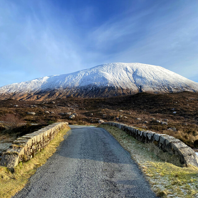
Bridge over the Abhainn Ceann Loch Ainort
The bridge carries the Moll road, now closed as a through route by the 2018 landslip. NG5629 : The Moll Road landslip
The hill in the background is Glas Bheinn Mhòr.
The hill in the background is Glas Bheinn Mhòr.
 Map © Crown Copyright")
TIP: Click the map for more Large scale mapping
- Grid Square
- NG5327, 40 images (more nearby 🔍)
- Photographer
- John Allan (more nearby)
- Date Taken
- Monday, 1 February, 2021 (more nearby)
- Submitted
- Wednesday, 3 February, 2021
- Subject Location
-
OSGB36:
 NG 539 270 [100m precision]
WGS84: 57:16.0587N 6:4.9880W - Camera Location
-
OSGB36: NG 539 270
- View Direction
- East-southeast (about 112 degrees)