2019
TQ3081 : Ripple marks in Haslingden Beds, Bloomsbury Square
taken 4 years ago, near to London, The City of London, England
This is 1 of 2 images, with title Ripple marks in Haslingden Beds, Bloomsbury Square in this square
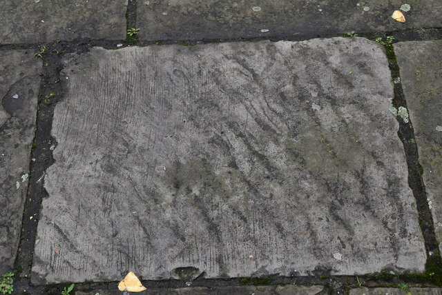
Ripple marks in Haslingden Beds, Bloomsbury Square
Bloomsbury Square is a garden square in Holborn. Developed in the late 17th century, it was initially known as Southampton Square and was one of the earliest London squares. By the early 19th century, Bedford House along the north of the square had been demolished and replaced with terraced housing designed by James Burton.
Wikipedia: Link
See other images of Bloomsbury Square
Wikipedia: Link
See other images of Bloomsbury Square
 Map © Crown Copyright")
TIP: Click the map for more Large scale mapping
- Grid Square
- TQ3081, 3103 images (more nearby 🔍)
- Photographer
- N Chadwick (more nearby)
- Date Taken
- Thursday, 28 November, 2019 (more nearby)
- Submitted
- Saturday, 6 February, 2021
- Subject Location
-
OSGB36:
 TQ 3034 8166 [10m precision]
WGS84: 51:31.1298N 0:7.3707W - Camera Location
-
OSGB36: TQ 3034 8166
- View Direction
- Northwest (about 315 degrees)